Muktinath – should I call it an adventure destination or religious destination?
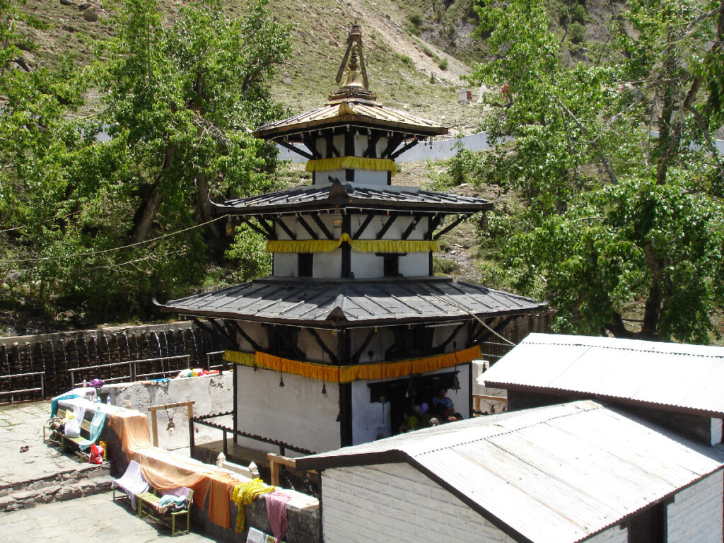
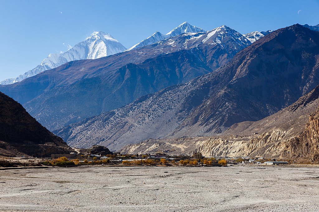
Muktinath is a sacred site for Hindus and Buddhists. It is located in Muktinath Valley at the altitude of 3800 meters at foot of the Thorong La mountain pass in the Lower Mustang region of Nepal. It is also one of the world’s highest temples. You can watch high elevated fascinating mountain ranges at the south from the temple and view of Tibetan plateau to the north side.
Within Hinduism, Muktinath is Mukti Kshetra which means the place of liberation or salvation. This temple is considered one of the 8th sacred places and one of the 51 Shakti Pitha. The main temple of Muktinath is the Pagoda style dedicated to Vishnu. Temple consists of middle statue of Vishnu, Goddess Saraswati, Janaki, Garuda, Lava Kusa, and the Sapta Rishi. The outer courtyard of Muktinath temple has 108 bull faces taps through which water is poured. Ice cold water from Kali Gandaki River has been diverted in these taps. The front of the temple has two holy ponds. Devotees’ takes bath in these 108 taps and have a dip in these 2 ponds believes to bring salvation after death.
Religious significance
The temple is classified as one of the Divyadesam, one of the 108 Vishnu temples that are mentioned in the book. There are 108 temples, 105 are in India, one is in Nepal, and the last two are believed to be outside the Earthly realms. In India, they are spread over states of Tamil Nadu (84), Kerala (11), Andhra Pradesh (2), Gujarat (1), Uttar Pradesh (4), and Uttarakhand (3). Muktinath, Saligramam is the only Divya Desam in Nepal.
This temple is considered to be 106th among the available 108 Divya Desam considered sacred by the Sri Vaishnava sect. Its ancient name in Sri Vaishnava literature is Thiru Saligramam. The Gandaki river near by is considered the only source of the Saligram shila, considered to be the naturally available form of Sriman.
The riverbed of the Gandaki river has Shaligram stones that are used to worship Lord Vishnu.
Note: To be honest I was not aware of religious sinificance when I went, got to understand while doing some research for writing this blog. Now I feel how lucky I am to get this oppurtunity.
Adventure significance
The Annapurna Circuit is a trek within the mountain ranges of central Nepal. The total length of the route varies between 160–230 km. This trek crosses two different river valleys and encircles the Annapurna Massif. The path reaches its highest point at Thorung La pass (5416m/17769 ft), reaching the edge of the Tibetan plateau. Most trekkers hike the route anticlockwise, as this way the daily altitude gain is slower, and crossing the high Thorong La pass is easier and safer.
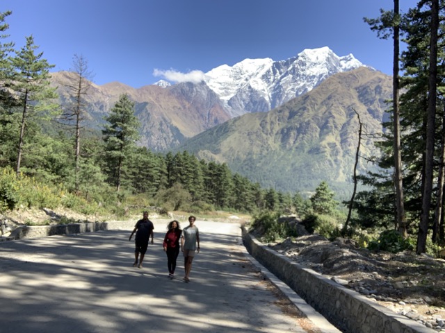
The trek begins at Besisahar or Bhulbhule in the Marshyangdi river valley and concludes in the Kali Gandaki Gorge. Besisahar can be reached after a seven-hour drive from Kathmandu. The trail passes along paddy fields and into subtropical forests, several waterfalls and gigantic cliffs, and various villages. This circuit includes Mukthinath as part of the Trek.
How to Reach
From Pokhara, there are two ways of reaching Jomsom, the entrance to Lower Mustang (or three, if you wanted to trek the whole way): by air or by bus/jeep. Flying is by far the quickest and most comfortable option if a little daunting: flights leave early to avoid the strong winds that whip through Mustang by late morning.
Although the flight is a short twenty minutes, they are memorable minutes as you soar through the Kali Gandaki Gorge, with Dhaulagiri and Tukuche to the west, and Nilgiri Central and Annapurna to the east. Taking a public bus or private vehicle between Pokhara and Jomsom is the ‘adventurous’ option, but can take more than ten hours along uncomfortable roads.
Weather
The months of September, October and November are regarded as the best months to visit Muktinath temple. The average temperature condition is experienced in these months. Slight rainfall can be experienced in early September but the experience is finest in these months.
Monsoon: June, July, August forms the monsoon season in Muktinath. Landslides are common occurrences during this season and better to avoid travelling during this season.
Spring: March, April, May forms the spring season in Muktinath. It is good time to travel since the temperature will be moderate. This is best season to explore Mustang area.
Autumn: September, October, November forms the autumn month. This is another peak time for the pilgrim to visit Muktinath. This is the season when the weather is cool, comfortable and pleasant. You will be able to see some snow capped mountains due to clear sky.
Winter: December, January, February forms the winter season in Muktinath. It is very cold and chilly in this area, if you can bear the cold weather you can do some trekking. Muktinath temple will be covered by snow, so better to take helicopter service.
Places of visit around Muktinath
Jomsom is a single-street town full of lodges facing east, to the stunning mountain views that dominate the town. A good half-day excursion from Jomsom is to visit Marpha village is nice. Half-day excursions are the best type anywhere in Lower Mustang, as the afternoons can be unpleasantly windy and cold, meaning the shelter of a lodge is more comforting.
Marpha itself is a clean, pretty town watered by paved canals of the sort found all over the Tibetan-influenced world. It’s surrounded by patches of green, irrigated farmland.
While Jomsom has its nearby attractions, the town of Kagbeni deserves a bit more time. It takes about an hour to reach Kagbeni from Jomsom via private vehicle, over bumpy roads, or a trek of three-four hours. The Buddhist culture of the town that Peissel described fifty years ago is still evident today, with rows of large prayer wheels, a monastery that blows its horns at the break of dawn, and Tibetan-influenced architecture.

Our Experience
It was in 2021 Oct when the whole world was shut for travel due to Covid, we had 10 days of holiday for Dussera and was thinking where to go. We were looking for all options, that’s when we saw in paper that Nepal had opened for tourism after 1.5 years of lockdown. We decided we will try our luck to visit Mukthinath, which my brother was mentioning as the worlds deadliest drive.
We booked the ticket to Siligury just the previous night of travel. Though the price were quiet high, we did not have a second thought, since we din’t travel for a year now and we had a budget saved.
Day 1, we flew to Siligury and hired a Mahindra Scorpio after confirming with the guy if the land way entry to Nepal was opened.
Note: There are around 30 to 35 entries by land to Nepal from India. There is one in Panitanki town, which is 10 km from Siligury.
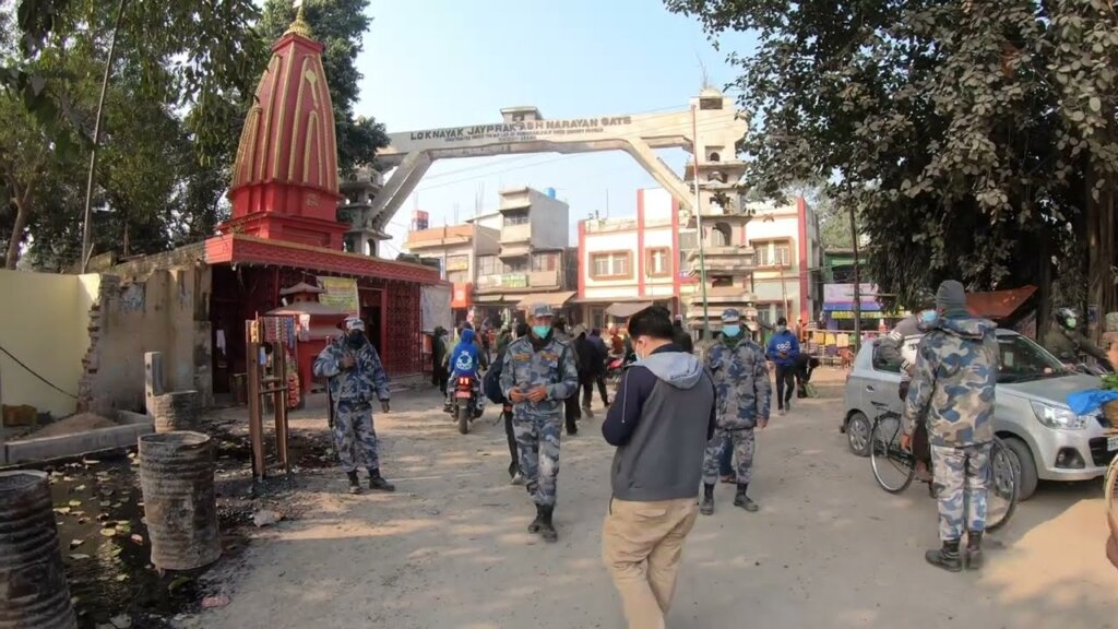
We went to Siligury with fully covered face masks in the flight and on arrival the car rental guy was waiting in the airport. We picked up the car and drove to Panitanki, which is the nearest land entry to Nepal from Siligury. We arrived at Panitanki and noticed 100’s of cars parked in queue and there was full chaos there. When we enquired we got to know that the border was not open. Though in media it was mentioned the entry is open to Nepal, this border was closed and the reason they said was this border force dint get the written intimation for opening the border. We dint know what to do and enquired the border force security person and he said, the Britanagar border was open and it was around 200 km from here.
Anyway we were there and nothing to do for next 10 days, so decided to try Britanagar entry. We drove the whole day and reached Britanagar around 6 pm, and was worried if the border will close since few people were mentioning that the border will close by 5 30 to 6 pm. It was chaotic market place that we need to cross to get to the border. People cross Nepal border and come to Indian border and shop and go for weekly provisions. We reached the border by 6.30 pm, and the border was open still. With a great relief we checked for the procedures to drive into Nepal with a Indian vehicle.
Though no visa needed to enter into Nepal for Indians, still carry your passport. They will check the passport. For the vehicle you need to take a road permit. There are many agents standing outside the office, you pay them a little they help with the permit. They gave the permit for 1 week, but we insisted to give the permit for 2 weeks which they denied and gave for only 1 week and told us to renew in Kathmandu.
Note: Try and request for 2 week permit, since renewal of permit can be done only in Kathmandu and if you don’t have permit they charge a hefty fine.
By the time we completed these procedures it was 8 pm, and finally we entered Nepal. Now our plan was to go to Pokhara and it was 570 km from Britanagar. Even for next day to drive 570 km, in an unknown terrain that too in Himalayan ranges would be hectic, so we decided we will cover as much as possible that night and stay in a road side travel motels and continue the next day.
We drove till 10 pm and we noticed we are heading no where and not able to find a stay place, since all the town which came on the way was small and no decent stay places were available. Finally around 11 pm we decided what ever hotel we get we will stay, and went around hunting for hotels. We had to wake up the people in the hotel in the middle of the night and check if there are rooms available. Finally we found a decent place to stay that night. By 12 pm went hunting for food, and stopped in a place where lorry drivers have dinner on their long journey in the late nights. There we had thankali bancha, the local cuisine; to my surprise it was amazing. I decided next 10 days I am going to have this Thakkali bancha.
Tip: Thankali Bancha is a local cuisine in Nepal. Thakkali’s are the local tribes of Nepal and their authentic food is called Thakkali bancha. It comes with rice, vegetable, gravy, curry and you can add extra dish of chicken/Mutton/Fish.
We went to the hotel and slept that night. Next day morning we decided to leave by 8 am, only then we can reach Pokhara by night, since the journey will be in Himalayan rough terrain. Generally the roads were bad in Nepal. We left at sharp 8 am morning, the drive was good, and it started getting dark by 5 15 pm, after which it became difficult to drive in dark, narrow and bumpy roads with cliffs on one side and drainage pit on the other side. Finally we reached Pokhara by around 8 pm, and again started to hunt for hotels. We were lucky to get a room in one of the best hotel in Nepal, Temple Tree Resort.
Tip: If you are travelling during Dussehra time, make sure you book your hotels well before in hand. The festival is celebrated in a big way in Nepal, and all the hotels are booked in advance.
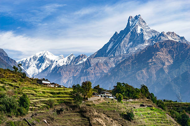
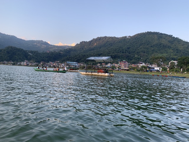
Day 3, we relaxed in Pokhara. I would say this was the only day in our whole 10 day trip we dint drive, else all other days we drove for a minimum of 10 hrs. It was a nice relaxing day and from the swimming pool we could get the view of snow clad Annapoorna range.
That day we went to few pubs, and restaurants and also to Phewa lake and did boating with the view of Annapoorna range.
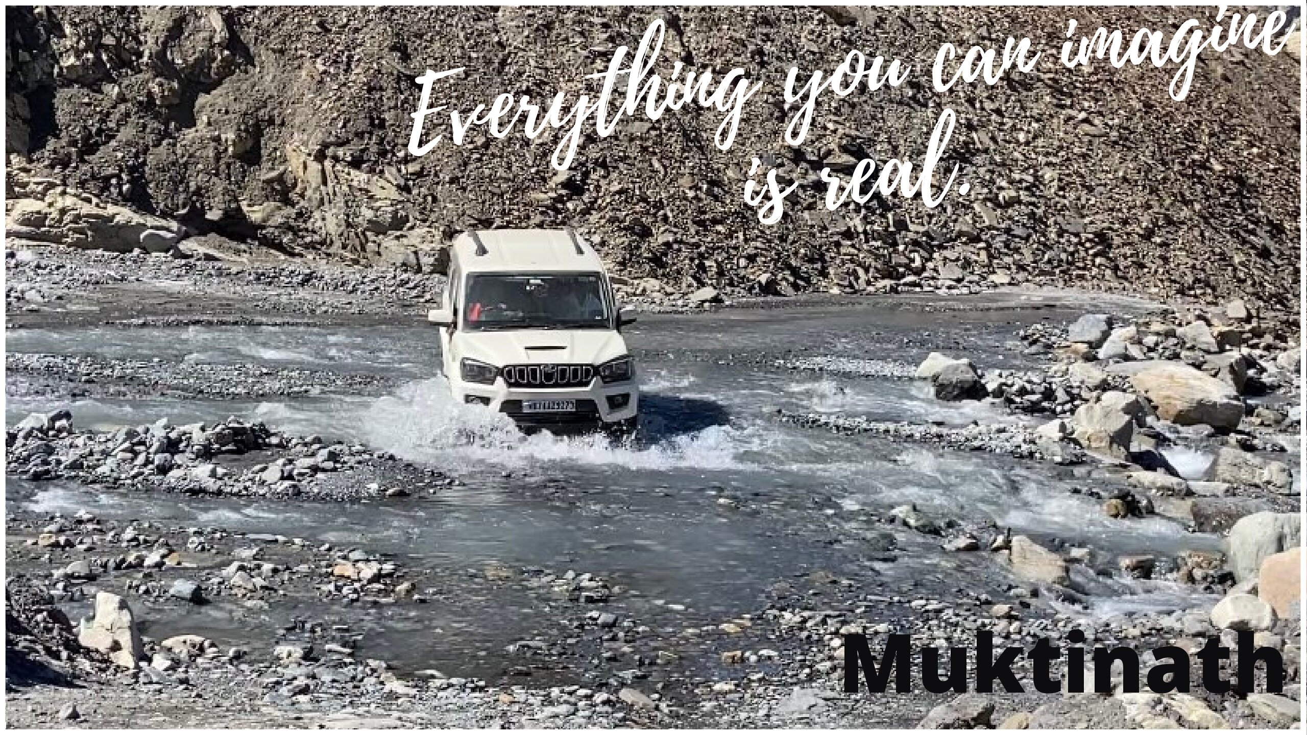
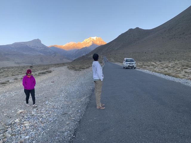
Day 4, we decided to drive to Mukthinath. Mukthinath is hardly 170 km from Pokhara, but that is a treacherous drive. It is said to be the world’s deadliest drive. My brother advised not to do this drive since I have spine surgery done, and to better take a flight to Jhomsom and take a taxi to Mukthinath which is 1 hr drive and which will make life simpler.
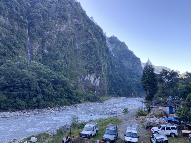
We did enquire with few people and they did say it is tough but not really as the media potrays. We decided we will drive and try it, if it’s too difficult we will return back, anyways we did not have any particular agenda for the trip. We started and for first 2 to 3 hrs the road looked ok, and gradually started to getting bad. It was becoming evening and we know it will be worst in dark, the road also started becoming worst. It was like we were literally driving on big boulders and crossing rivers. We decided to stop that night in Tatopani and continue the next day. Tatopani is a quaint little village along the river bed of Kali kandaki. We found a nice Thakkali Bancha Ghar. It is a small high way hotel type. The food was amazing and enjoyed their Thakkali bancha.

We enquired about the condition of remaining stretch of the road, for which they said be careful and drive slow.
Day 5, we started, and the initial stretch itself was very bad. The view was nice, but could not enjoy it much thinking of the roads. I remembered by brother telling, don’t do this road, what he said was true. There were stretches where we wondered how are we going to cross this stretch? We noticed all the vehicles on that road was a four wheel drive vehicle, we are the only people in two wheel drive. May be if it was a four wheel drive vehicle it would have helped a little. In few slopes only jarring noise of engine was coming with full accelerator press, but the vehicle was not moving. With great difficulty we reached Jomsom.

Tip: Never try this road in monsoon. It’s the deadliest road during monsoon.
Jomsom is a small town in the Mustang area of Himalayan range. The whole town was dusty. The wind is very harsh and so the flights fly only in the morning when the wind is little less. By afternoon it becomes very windy.
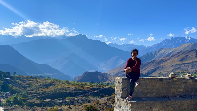
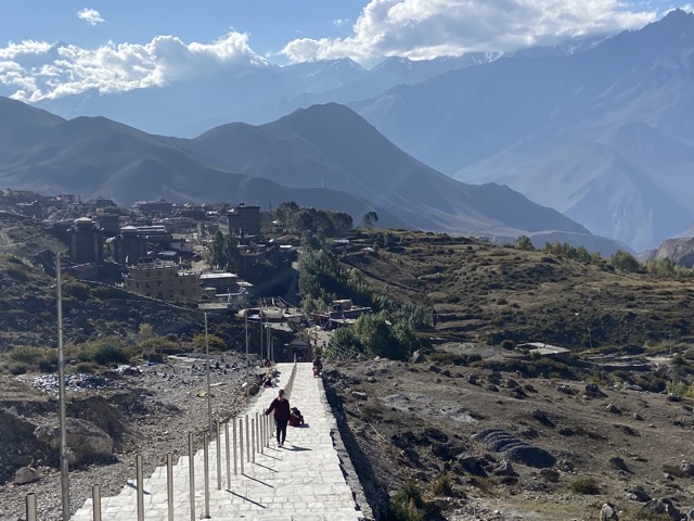
The same day evening we decided to visit Mukthinath. It is 1 hr drive from Jomsom. The road was quiet good from Jomsom to Mukthinath. I meant good road when compared to the Jomsom road. Mukthinath had a 1 hr walk up the hill. It was a quiet place, not many tourist or trekkers, because not many knew Nepal was open for tourism.
We came back to Jomsom, and started hunting for hotels as usual for that night stay. Surprisingly in that small town, there were restaurants with live music which we enjoyed and also found a decent place to stay that night. By then I was paranoid with the dust there, I wanted to leave the place next day morning. Also my back started hurting by now. Still I decided to leave this place and take a good rest after reaching Pokhara.
Now when we thought of leaving, the risky roads flashed in front of our eyes. We thought it is better to take a local driver till Tatopani and after which we can manage to drive. But it was so difficult to get a driver, since it is Dussera festival there and it is an important festival for Nepalese. Finally we found a driver and agreed to pay a hefty price and hired him to drop us till Tatopani which will be 6 hrs.
Note: We met a couple in the Mukthinath temple asking for a hitch hike ride, since we were planning to visit Kagbeni a town in between Mukthinath and Jomsom, they could not join us. But when we reached Jomsom in the night, we met them in a Café and had a conversation with them. The guy mentioned, the bus that they took from Pokhara to Jomsom on the way slid in a valley and one of the wheels slipped in the valley and they had to pull out one by one out after a JCB pulled the bus up. He was mentioning that he is not taking the bus back, he will stay in this town until flights resume. The flights were cancelled for 4 days during that time due to bad weather.
Note: Flights getting cancelled due to bad weather is a common scenario. So planning should be made keeping this in mind.
Day 6, hired driver who came to the hotel driving a bus and parked the bus in one corner and said we can leave. We thought wow super good driver and thought now we are safe to reach back Pokhara. We told him to show around the Jomsom town for half a day and left the town by afternoon. For once I realized how good it was to sit in a passenger seat and enjoy the Himalayan view rather than to be on a driver seat. Then came the spot, which we were scared to cross and the whole reason to hire this driver giving such a heavy fee.
Many vehicles were in the queue, and were crossing one by one. Our turn came, and the car was not pulling and only jarring noise came from engine. It was a slope and a narrow turn with one side deep gorge and a huge rock on the other side. We decided to get off the vehicle, so that at least 150 kg weight will be reduced and it will make it a little easy to pull. Still nothing worked. We saw ours was the only 2 wheel drive vehicle and all others were 4 wheel drive vehicles.
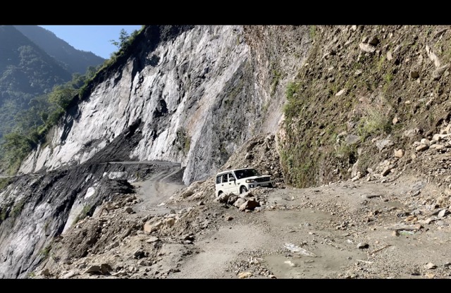
The driver was also sweating, and still trying his best. It was like literally driving on rocks. Then one driver from the other vehicle came and told this driver to get down, and he tried and could cross that spot. By then there were already 15 vehicles queued up, and all were watching this scene and applauded this driver for successfully crossing it. Then our hired driver took over and we reached Pokhara that night. We and our car looked as if we bathed in dust.
It doesn’t end here; again we went on Hotel hunt for an hour and got a place to stay. Temple tree resort which we stayed last time was fully booked. So booked another hotel which was also a nice place, took a fresh shower and headed for a nice dinner with a big sigh, aah reached back safe.
Day 7: We were thinking of heading back to Siligury, and there were 2 options one directly we could go, which will be 15 hrs. Other option is to go via Kathmandu which will be 23 hrs of drive. Shopping in Kathmandu is very good, since all the trekkers from all over the world head to Kathmadu for trekking of Everest, Everest Base Camp, Annapoorna circuit etc, the place is filled with top end trekking gears. Though we will have only 6 to 7 hrs in Kathmandu if we take that route, we decided to do it. We drove to Kathmandu and reached by 6 pm in the evening.
We were running from one shop to another and did a good shopping of adventure gears. Found a place to stay that night. Found a luxury place to stay and relaxed the next day morning and left that afternoon.
Tip: Kathmandu is a nice place to shop adventure gears. You get all top notch brands and for a good price too.
Day 8: We left to Siligury and it was 16 hrs drive we knew we can’t do in a day, so decided to stop by a highway hotel. The drive was good with nice view and got dark by 5 30 pm. We had to drive crossing the complete Himalayan range by night. I felt bad that I am missing a nice view of Himalayas. By 1 am reached Janakpur area and stopped for a night stay. It started raining from the time we left Pokhara, it was continuous rains and all the rivers which we saw was dried while going, now was overflowing that too in hardly in a gap of 7 days.
We had to wake up the security in the middle of the night and he helped us find the room and we relaxed that night. We all were too tired by now, and was thinking one more day to go.
Day 9: Started that morning and thought of exiting in the same border Britanagar the town which we entered. We thought, if we should try Panitanki border, since we have already seen Britanagar, but we decided we can’t take that risk, since if the border is closed still, it is another 15 hrs of extra drive for us. So we decided to go with Britanagar.
We drove all the way back till Siligury and the rain did not stop a single minute. Few flights were cancelled due to heavy rains, we were keeping our fingers crossed and finally our flight was not cancelled. We could successfully board the flight next day morning and reached Bangalore. Felt happy to be back home safe.
After 2 days in News paper saw the news, flash floods in Nepal and all the places that we went were water logged and many people died. I was thankful to God, we got a perfect window to visit Muktinath and reached back safe.
Finaly I would say trekking this route would have been much easier than driving in this route. And here the story of ‘Muktinath – should I call it adventure destination or Religious destination?’ ends…
3 Comments
Leave a Reply to Suchithra Cancel reply

Amazing narration Amudha. Excellent write up. You have given every finer details for the travel lovers. You have sectioned your experiences under beautiful headings. The blog not only gives excellent tips for those who wish to visit Mukthi nath, but also inspires adventurous travellers and spiritual lovers to plan their next trip. Keep travelling. Keep enjoying. Keep living.
Thanks Suchitra.
Amazing article and photographs, thank you